GPS for Field Data Collection in Kenya

Tuesday, July 2nd, 2013

Field data collection in Kenya has traditionally been done with paper and pen. This type of data collection was cumbersome and prone to errors. Nowadays, modern handheld GPS devices are available in Kenya to make field data collection easy, accurate and fun.

The Garmin handheld GPS we sell are good at doing the job of field data collection.

The Garmin eTrex (10,20,30) have USB slots that makes it easy to transfer you saved filed to your computer or laptop.

These GPS are excellent for field work. They are rugged, water proof, and use replaceable AA batteries. It doesn’t matter what the weather is, dusty, wet, dirty, cold or hot. They will work in extreme conditions.

Handheld GPS for Marking Underground Water Pipes

Thursday, June 27th, 2013

Handheld GPS can be used to mark the exact location of underground water pipes. This is important to a multitude of water companies across Kenya. Traditionally, water pipes were located through guese work by digging up all over until you found the exact pipe. This was time consuming and wasteful. Today, with a GPS receiver, field patrollers can locate the exact location of  an underground water pipe.

A handheld GPS system is a tiny and compact GPS device utilized for navigating or pinpointing varied locations.

The construction of GPS receivers has changed phenomenally. Older, bulkier handheld GPS receivers are being replaced with a smaller pocket-sized GPS units.

GPS features may include:Availability of additional GPS softwareMap databaseVoice activated GPS

Waas technology

Reflectionless screen

Theft prevention functions

Option for personalized screen icons

wireless file transfer

Choosing a GPS for use in marking underground water pipes

The particular handheld GPS receiver you choose is personal and will depend on the type of gps software and gps mapping programs best suit your needs. The size of the receiver, its weight and the antenna are things that can affect the mobile GPS unit. What you want or need in these areas will determine what options will come with your choice of model. If you opt for the smaller, cell phone sized unit, you know the viewing screen will likewise be small. Be sure that you select a portable GPS receiver that has mapping capabilities, updateable software and the ability to download from your computer. You will also want to make sure that the unit you are considering is waterproof or water-resistant and it should also be shock resistant just in case it is subjected to being dropped. Asking the right questions will assist you in making sure you get the handheld GPS receiver that will fill your wants and needs and, at the same time, fit your budget.

Handheld GPS for Land Surveying

Thursday, June 27th, 2013

Handheld GPS devices are used extensively in the world of land surveying. 10 years ago you would find a civil engineer or land survey in kenya using papers and a compass to survey land, today the most sophisticated are using a handheld GPS receiver.

Understanding two types of GPS

Handheld GPS devices represent a special category of all available GPS (Global Positioning System) receiver units used in various situations and for different applications. The major applicability or usefulness of handheld, portable GPS devices can be divided into two distinctive categories, i.e. for outdoor leisure and sport activities like hiking, trekking, climbing, camping and running and, secondly, for industrial applications like land surveying and position measurements at construction sites. Utilizing the GPS navigation satellite system, correct location of the GPS receiver can be determined by retrieving exact longitude, latitude and altitude coordinates. Today, most GPS receiver units, whether handheld or not, communicate through radio signals with at least four GPS satellites, whereby three satellites determine the exact location of the receiver and the fourth satellite is used for correcting the receiverâEUR(TM)s clock. After the Selective Availability regulation, which provided certain accuracy reservation for military use, was ended in 2000, the precision of civilian GPS improved from about 100m to about 20m.

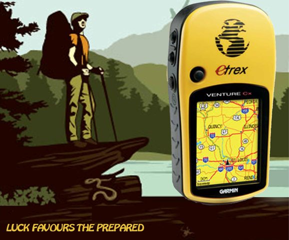
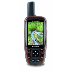
Handheld GPS devices provide tremendous flexibility and convenience for the user. Not only can the user continuously monitor his, or her, exact and current geographical location and path of travel, but handheld GPS devices can be fitted for relaying with central offices or base stations that can track or follow the user for security and safety reasons. For example, GPS devices that can communicate with and supply coordinates to a central station are very popular by mountain climbers and hikers. As the GPS system has developed and improved over the past years, many new applications have emerged for the users of handheld GPS devices. Not only can users determine their current location, but also obtain a multitude of additional and supportive information through geographical maps, inserted in the GPS receiver units, such as precise navigation, locations of restaurants and hotels, weather reports, tourist attractions, etc. Currently, there are a number of companies producing and offering many different handheld GPS devices. Some of the best known include, Garmin, Magellan and DeLorme. The devices have a broad range of features, attributes and, of course, price tags. Before selecting a particular handheld device, it is important to know what you will be using it for. For example, a GPS device used for hiking may be less applicable for mountain climbing or, even less, running. Obviously, devices for industrial applications have particular requirements and qualities. If you are looking for a handheld GPS device that can be used in different circumstances, a multipurpose unit could be the answer. Furthermore, you need to have an idea of what features you are interested in or require in addition to the standard GPS and mapping functionality, e.g.:

  • Touch screen window
  • Color screen or black and white
  • Built-in camera (like in mobile phones)
  • SD (memory) card expandability
  • Voice recorder
  • Built-in electronic compass
  • Barometer
  • MP3 Music Player
  • External antenna connector
  • Etc. etc.

Obviously, as the feature list increases, so does the price. Another important thing to keep in mind is considering what geographical maps may be included or applicable to your needs, e.g. outdoor and recreational maps, street maps or marine maps. Most handheld GPS devices come with some pre-loaded or built-in geographical maps, for example a base map of the USA and Canada containing major highways, city centers, bodies of water and more. You need to find out whether you need additional detailed maps that can be added to the handheld device, for example detailed cartographic maps, topographic maps, and more.

Still another important issue to keep in mind is the GPS software that is normally included with the purchase of a new handheld GPS for uploading GPS data to a computer. By that you can conveniently view all your maps, waypoints, trails and routes from your computer screen. Many other interesting advanced features and possibilities can be implemented with an appropriate handheld GPS receiver including, playing “hide-and-seek” and “treasure-hunting” through geocaching or importing your tracks, waypoints and routes into Google Earth for tracking and monitoring. In short, handheld GPS devices offer a plethora of wonderful possibilities and options.

Handheld GPS for Field Work by NGOs and Large Organizations

Thursday, June 27th, 2013

The biggest buyers of hadnheld GPS devices in kenya are NGOs(Non Government Organisation and corporate bodies. These organization are using GPS for field work operations. They are using handheld GPS to obtain a multitude of additional field work data and supportive information through geographical maps, inserted in the GPS receiver units, such as precise navigation, locations of key subjects, exact path etc.

How to Choose GPS for your organization.

How Many Waypoints are There?

Waypoints are reference points and they help to show your location. They are extremely useful in helping to sort the best routes for your trip as they leave a kind of breadcrumb trail for you. It is suggested that a decent handheld GPS should be capable of storing at least 500 waypoints. That way you are covered whether you are on the water, in the wilderness or on the road.

What are the Maps Like?

Maps of course of an extremely important feature of any GPS device. Each receiver will come with different types of maps. It would be wise to decide beforehand what type of maps you will need the most as well as how detailed you would need them to be. A typical handheld GPS will come with a certain amount of maps already stored within and some will have the capability of adding more maps if you need them.

Enough Storage

Check to see if the model has enough storage space to be able to upload specific maps that you may need down the road. This is not such a big issue this days because most GPS devices can with a slot for inserting an external memory card.

Is it Waterproof?

A waterproof unit is far more versatile and can be used in the rain, while riding a motorcycle, or even while boating or kayaking.

If you choose a waterproof unit then look for a waterproof rating of IPX7. This means that it can withstand accidental dunks, rain as well as splashes from water. It can also float.

Deciding Which One to Buy

After considering all of the important features above do a little research and watch out for units that offer a lot of unique features that not only drive the cost up but also may never get used

Top 6 Handheld GPS Manufacturers

Thursday, June 27th, 2013

Handheld GPS units are extremely popular for a variety of outdoor activities such as hiking, geocaching, hunting, kayaking, snowshoeing, and skiing. Although there are many different GPS manufacturers to choose from there are six main manufacturers that are extremely popular for handheld GPS devices. Each company has their own unique models to choose from.

Below are the six most popular manufacturers to consider when searching for a GPS device.

GPS Manufacturers

Garmin
Garmin is likely one of the most popular manufacturers for GPS units as well as many other products. Garmin began its business 21 years ago in 1989. They comprised at that time of a few engineers who got together to develop and construct navigation and communication devices. Today Garmin has offices all over the world and well over 7,000 employees. They design and market units for:

  • Automotive navigation
  • Marine devices
  • Aviation
  • Fitness
  • Wireless GPS for smart phones
  • Outdoor receivers

The Garmin handheld GPS units are well known for offering great quality as well as the latest technology. They are often voted the best in their class.

At the moment Garmin is the only one available in Kenya.

Magellan
The Magellan Corporation has changed ownership and name several times. The original Magellan Corporation was founded in 1986 but in 2001 they were acquired by Thales, a large electronics company. In 2006 Thales Navigation was purchased by Shah Capital Partners who changed the name to Magellan. Then in 2009 they were bought out again by MiTAC International Corporation. The consumer GPS units are still marketed under the Magellan brand. They have an extensive line of handhelds as well as automotive navigation devices. Despite the constant change of ownership Magellan still does and always has produced good quality GPS units.

DeLorme
DeLorme has been in business since 1976. They create technology, mapping products, and data not only for consumers but also for professionals. Although they always produced great quality products they really earned a name for themselves in the 1990’s when they pioneered GPS solutions for laptops, Palm OS devices, Pocket PC’s and recently for Bluetooth applications and color topographic maps and aerial imagery. They have a fairly good selection of handheld units to choose from.

Lowrance
Lowrance Electronics Inc. is one of the oldest GPS manufacturers. They began in 1957 and have a pioneer in developing Global Positioning System mapping instruments. They have an extensive line of SONAR and GPS units for outdoor recreation as units for aviation, marine and automotive. They have a decent selection of handheld GPS units.

Bushnell
Bushnell offers a wide range of outdoor technology tools such as binoculars, scopes, rangefinders, trail cameras, flashlights and of course handheld GPS units. They have been in the high performance sports optics industry for over 50 years. They only have a few handheld GPS receivers but they are tailored for all outdoor activities. More basic in design and features than the other GPS manufacturers listed above their units are ideal for any sportsman looking for a GPS device made simple.

TomTom

TomTom is a Dutch manufacturer of GPS navigation systems, including both stand-alone units and software for personal digital assistants and mobile telephones. It is the leading manufacturer of navigation systems in Europe.

Handheld GPS Now Available in Nairobi Kenya

Sunday, June 23rd, 2013

Looking for handheld GPS device? You have come to the right place. We stock and sell Garmin Etrex Handheld GPS. We supply free of charge to buyers located in Nairobi.

Our Garmin eTrex line of Handheld GPS are excellent for workers doing field work, outdoor enthusiasts, nature trekkers, mountain climbers and campers.

Why a Handheld GPS is Good for your organization

There are no maps for forests and jungles, and compasses provide a very little navigation system. Markings and flagstones can do the trick, but there are many circumstances in which these tracking methods are no effective. These nature trekkers need something more advanced and efficient. For such needs, there is the Garmin Handheld GPS, a hand-held GPS device.

Garmin Handheld

The Garmin Etrex Handheld GPS is a little yellow device. Measuring only two inches wide and four inches high, it can fit comfortably in the palm of the hand. The bright yellow color is as it is so that it can be found easily anywhere.It has intuitive buttons, easy-to-use features and lightweight body – perfect for all kinds of nature expedition. One won’t have to worry about wet condition, because the Garmin eTrex is waterproof.Withinthe easy reach of all the fingers, its five buttons are located on both sides of the device.

The Garmin Etrex Handheld GPS is also designed for long treks and weekend adventures. On just 2 AA batteries, it can last up to 22 hours. This device also has a good way-points memory, up to 500, that are easily retrievable. One will only to point his destination, and voila the Garmin Handheld GPS will show the way. It even has a Track Back feature, for getting back to the starting point and going home.

Available Handheld GPS in Kenyan Market

We sell the following models in Kenya

  1. Garmin eTrex 10
  2. Garmin eTrex 20
  3. Garmin eTrex 30

How To Get Garmin Etrex Handheld GPS For The Best Price?

Call us on the numbers at the top of the website or simply send us an email.

Garmin eTrex 30 vs GPSMAP 62s

Saturday, May 25th, 2013

A Comparison of the differences feature between Garmin eTrex 30 and GPSMAP 62s

Garmin Handheld GPS

eTrex 30

GPSMAP 62s

  Garmin eTrex 30, Worldwide
Garmin GPSMAP 62S Handheld GPS Navigator
The Difference Features 1. Unit dimensions, WxHxD: 2.1″ x 4.0″ x 1.3″ (5.4 x 10.3 x 3.3 cm)

2. Display size, WxH: 1.4″ x 1.7″ (3.5 x 4.4 cm); 2.2″ diag (5.6 cm)

3. Display resolution, WxH: 176 x 220 pixels

4. Weight: 5 oz (141.7 g) with batteries

5. Battery life: 25 hours

6. Interface: USB
1. Unit dimensions, WxHxD: 2.4″ x 6.3″ x 1.4″ (6.1 x 16.0 x 3.6 cm)

2. Display size, WxH: 1.43″ x 2.15″ (3.6 x 5.5 cm); 2.6″ diag (6.6 cm)

3. Display resolution, WxH: 160 x 240 pixels

4. Weight: 9.2 oz (260.1 g) with batteries

5. Battery life: 20 hours

6. Interface: high-speed USB and NMEA 0183 compatible

YouTube Video Demo / Review

  • N/A
  • N/A
Price Check

Common Features for both Garmin:

  • Display type: transflective, 65-K color TFT
  • Battery: 2 AA batteries (not included); NiMH or Lithium recommended
  • Waterproof: yes (IPX7)
  • High-sensitivity receiver: yes
  • Basemap: yes
  • Ability to add maps: yes
  • Built-in memory: 1.7GB
  • Accepts data cards: microSD™ card (not included)
  • Waypoints/favorites/locations: 2000
  • Routes: 200
  • Track log: 10,000 points, 200 saved tracks
  • Automatic routing (turn by turn routing on roads): yes (with optional mapping for detailed roads)
  • Electronic compass: yes (tilt-compensated, 3-axis)
  • Barometric altimeter: yes
  • Photo navigation (navigate to geotagged photos)
  • Custom maps compatible: yes
  • Geocaching-friendly: yes (paperless)
  • Hunt/fish calendar: yes
  • Sun and moon information: yes
  • Tide tables: yes
  • Area calculation: yes
  • Custom POIs (ability to add additional points of interest): yes
  • Unit-to-unit transfer (shares data wirelessly with similar units): yes
  • Garmin Connect™ compatible (online community where you analyze, categorize and share data): yes

Unavailable Features:

Both eTrex 30 and GPSMAP 62s do not have the following features:

  • Floats
  • Preloaded maps
  • Touchscreen
  • Camera
  • Picture viewer
  • Outdoor GPS games

Disclaimer: Information provided is believed correct and true to the best of our ability, however, Galileo GPS Solutions is not responsible for typographical errors or incorrect data. To report any errors, please use the comment below or visit the official Garmin products page for details specifications.

Garmin eTrex Distributor for Kampala – Uganda

Monday, May 20th, 2013

Galileo GPS Solutions is a distributor of original Garmin eTrex. We sell to customers in Kampala and across all major towns in Uganda. We are based in Nairobi Kenya.

All Garmin eTrex products ordered from us are sent to clients via a trusted courier company (G4S Securities). Mode of payment is by bank transfer.  For details on prices, how to order and any help you may need, please send us an email at;

info@galileogps.co.ke

Popular Garmin Garmin eTrex models we sell to customers across Uganda

Garmin HandheldGarmin Etrex was introduced 10 years ago and has gained a lot of attention for its lightweight, waterproof, and bright yellow design. They are popular because of easy usability and great performance.

The Garmin eTrex 10 is the entry level model with basic features of a good GPS. Features include;

  1. Waypoints/favorites/locations: 1000
  2. Routes: 50
  3. Track log: 10,000 points, 100 saved tracks
The eTrex 20 is an improvement on the eTrex20. Added features include:-
  1. Ability to add maps
  2. Built-in memory: 1.7GB
  3. Accepts data cards: microSD™ card (not included)
  4. Waypoints/favorites/locations: 2000
  5.  Routes: 200
  6. Track log: 10,000 points, 200 saved tracks
  7. Automatic routing (turn by turn routing on roads): yes (with optional mapping for detailed roads)
  8. Photo navigation (navigate to geotagged photos)

Garmin eTrex 30 is the most sophisticated GPS in this line. This one has higher capabilities than the eTrex 20. Advanced features include;

  1. Electronic compass: (tilt-compensated, 3-axis)
  2. Barometric altimeter.
  3. Unit-to-unit transfer (shares data wirelessly with similar units)

To do a comparison see,

Garmin eTrex 10 vs eTrex 20

Garmin eTrex 20 vs eTrex 30


Garmin eTrex 20 vs eTrex 30

Monday, May 20th, 2013

A Comparison of the difference features between Garmin eTrex 20 vs 30

Garmin eTrex Handheld GPS

eTrex 20

eTrex 30


The Difference Features See common features below. 1. Electronic compass: yes (tilt-compensated, 3-axis)

2. Barometric altimeter: yes

3. Unit-to-unit transfer (shares data wirelessly with similar units): yes

YouTube Video Demo / Review
  • N/A
Price Check ksh. 29999

Ksh.37,999

Common Features for both Garmin GPS devices:

  • Unit dimensions, WxHxD: 2.1″ x 4.0″ x 1.3″ (5.4 x 10.3 x 3.3 cm)
  • Display size, WxH: 1.4″ x 1.7″ (3.5 x 4.4 cm); 2.2″ diag (5.6 cm)
  • Display resolution, WxH: 176 x 220 pixels
  • Display type: transflective, 65-K color TFT
  • Weight: 5 oz (141.7 g) with batteries
  • Battery: 2 AA batteries (not included); NiMH or Lithium recommended
  • Battery life: 25 hours
  • Waterproof: yes (IPX7)
  • High-sensitivity receiver: yes
  • Interface: USB
  • Basemap: yes
  • Ability to add maps: yes
  • Built-in memory: 1.7GB
  • Accepts data cards: microSD™ card (not included)
  • Waypoints/favorites/locations: 2000
  • Routes: 200
  • Track log: 10,000 points, 200 saved tracks
  • Automatic routing (turn by turn routing on roads): yes (with optional mapping for detailed roads)
  • Photo navigation (navigate to geotagged photos)
  • Custom maps compatible: yes
  • Geocaching-friendly: yes (paperless)
  • Hunt/fish calendar: yes
  • Sun and moon information: yes
  •  Tide tables : yes
  • Area calculation: yes
  • Custom POIs (ability to add additional points of interest): yes
  • Garmin Connect™ compatible (online community where you analyze, categorize and share data): yes

Unavailable Features:

Both eTrex 20 and 30 do not have the following features:

  • Floats
  • Preloaded maps
  • Touchscreen
  • Camera
  • Picture viewer
  • Outdoor GPS games

Disclaimer: Information provided is believed correct and true to the best of our ability, however, Galileo GPS Solutions is not responsible for typographical errors or incorrect data. To report any errors, please use the comment below or visit the official Garmin products page for details specifications.

Garmin eTrex 10 vs eTrex 20

Monday, May 20th, 2013

A Comparison of the differences features between Garmin eTrex 10 and 20

Garmin eTrex Handheld GPS eTrex 10 eTrex 20


Garmin eTrex 10 Worldwide Handheld GPS Navigator Garmin eTrex 20, Worldwide Handheld GPS Navigator
The Difference Features 1. Display size, WxH: 1.4″ x 1.7″ ; 2.2″ diag

2. Display resolution, WxH: 128 x 160 pixels

3. Display type: transflective, monochrome

4. Waypoints/favorites/locations: 1000

5. Routes: 50

6. Track log: 10,000 points, 100 saved tracks

1. Display size, WxH: 1.4″ x 1.7″ (3.5 x 4.4 cm); 2.2″ diag (5.6 cm)

2. Display resolution, WxH: 176 x 220 pixels

3. Display type: transflective, 65-K color TFT

4. Ability to add maps

5. Built-in memory: 1.7GB

6. Accepts data cards: microSD™ card (not included)

7. Waypoints/favorites/locations: 2000

8. Routes: 200

9. Track log: 10,000 points, 200 saved tracks

10. Automatic routing (turn by turn routing on roads): yes (with optional mapping for detailed roads)

11. Photo navigation (navigate to geotagged photos)

12. Custom maps compatible: yes

Prices
Ksh. 19,999 Ksh. 29,999
YouTube Video Demo / Review
Price Check

Common Features for both Garmin:

  • Unit dimensions, WxHxD: 2.1″ x 4.0″ x 1.3″ (5.4 x 10.3 x 3.3 cm)
  • Weight: 5 oz (141.7 g) with batteries
  • Battery: 2 AA batteries (not included); NiMH or Lithium recommended
  • Battery life: 25 hours
  • Waterproof: yes (IPX7)
  • High-sensitivity receiver: yes
  • Interface: USB
  • Basemap: yes
  • Geocaching-friendly: yes (paperless)
  • Hunt/fish calendar: yes
  • Sun and moon information: yes
  • Area calculation: yes
  • Custom POIs (ability to add additional points of interest): yes
  • Garmin Connect™ compatible (online community where you analyze, categorize and share data): yes

Unavailable Features:

Both eTrex 10 and 20 do not have the following features:

  • Floats
  • Preloaded maps
  • Touchscreen
  • Electronic compass
  • Barometric altimeter
  • Camera
  • Picture viewer
  • Outdoor GPS games
  • Tide tables
  • Unit-to-unit transfer (shares data wirelessly with similar units)

Disclaimer: Information provided is believed correct and true to the best of our ability, however, GPS Devices is not responsible for typographical errors or incorrect data. To report any errors, please use the comment below or visit the official Garmin products page for details specifications.